Sunday, October 24, 2010

Oct 11-12 2010


George drove us to Dulles Airport in the afternoon of the 12th and we took a British Airways 777 to London. We arrived a bit after midnight on Oct 13. We were in the back of the plane and reseated ourselves into some more open areas so we each had an empty seat next to us. We then took a British Air 767 and got to Ben Gurion Airport about 3 pm. We rented a Hyundai from Avis.

On the way to our apartment in Herzilya, I missed the main entrance to the building and took a side entrance into a parking lot. There was an impromtu Breslav dancing festival and a lot of people driving around the lot. I had to drive on the sidewalk to get around a car going in the wrong direction to get out of the parking lot.

Where we stayed


We stayed in Herzilya. We had an apartment on the 14th floor of a 16 story building. They had a pool on the 5th floor with a view of the beach to the north (see image of M in the pool).

From our apartment we also had a view north. The buildings seen are hotels but we could also see the buildings in Natanya, about 8 miles north of us.

Where we visited


We took two trips by car.

One was to Rosh Hanikra (which means 'Head of the Caves"). It is at the northwest tip of Israel about a half mile south of Lebanon on the coast of Mediterranean Sea.

The other was to Tiberias which is on the shore of Yam Kinneret (aka the Sea of Galilee).

For reference, Herzilya, where we stayed, is on the Mediterranean coast and would be a bit south of the bottom of this image.

We also went into Tel Aviv and Ramat Gam a few times for errands and to pick up Beth. This would be about 5-10 miles south of Herzilya.

The Coastal Highway (Kvish HaHof)

Along the highway between Herzilya and Rosh Hanikra, there is a lot to see. Among these are palm tree farms (Israel has been rapidly increasing their exports of palm trees which are used in landscaping developments in sunny warm areas all over the world). Ruins of Roman Aquaducts and the tall buildings of Haifa (the image is of the Sail Tower in Haifa which is about 450 feet tall).


All these images came from the internet. There is also an interesting transparent noise
barrier north of Caesaria and a light rail line being constructed north of Haifa (the construction detours slowed us up a bit. I couldn't find any good images of these.

Haifa itself was a barrier to travel because there was no bypass. A bypass would be difficult to build and very expensive because the Haifa area is very hilly (you can see the hills on the map in the post above this one). A tunnel is under construction and is to be opened in Nov 2010 as a toll facility. It will connect the coastal highway with west Haifa. This would be a partial bypass and for some people it will take 40 minutes and fifteen miles off some of their trips.


Rosh Hanikra Cable Car area Oct 14


There is a good long cable car ride from the top of the cliffs to a base area about half way down the cliffs. This area was an animal path in prehistoric times and then a marginally improved donkey-cart path for centuries but was leveled and expanded during world war II by the British for a train track between Haifa and coastal Lebanon.

The cable cars can take about 12 people at a time. One is going up while another is going down.

I took the image with me in the picture just to see if it would work.

The other picture shows a tunnel. This tunnel (once upon a time it was a tunnel that carried a railroad and still has the tracks in it) is actually a pretty good kosher restaurant. A big tour group was having a lunch buffet.

There are various stories told about this place. In one story, a young girl from Haifa was being taken to Tyre to be married to an older man she had never met. She threw herself off the cliffs into the waves and her signing is heard on still nights. Some of the caves are accessible from this level (including the one in the image - which is from the internet).

Rosh Hanikra has a good corporate website (with acoustics). The place is a national park owned by the government but services are contracted out (i.e., no park rangers, no government offices around).

Rosh Hanikra on the outside


There is a footpath and stairs from the base of the cable car area so you can go on the outside of the cliffs.


One image shows the base of the cliffs with the Mediterranean in the background.


Another shows a swimmer who is coming out of the grotto (the grotto is shown in the previous image with the picture taken from the top of the grotto).


There were about a hundred people on the middle level (where the grotto entrance and restaurant were) but only a few on the outside.

Finally, there is an image of the coast shot from the top of the cliffs (where there is a gift shop and another restaurant). I got this image from someone else's photo blog.

The cliffs are only about a hundred feet or so above the water but it seems more since almost all the Israeli coast is sandy beach except for this area.

Odds and Ends

On one day (I think the 14th) we got a parking ticket. We didn't know the protocol but apparently, blue and white color on the street means parking is permitted but sometimes there is a kiosk at which you buy time, get a receipt and put it inside the car on the dashboard. We didn't. Beth said she would pay but I was worried we would be charged twice. The rental car place said they (Avis) would pay the ticket and bill our credit card.


Another interesting item is that on the 17th we went to a Sephardic minyon near our apartment and at the post Shaharit kiddush, there was Carlsberg beer available. This was the first time I can remember having beer at a kiddush.


Of course its also interesting
since Carlsberg is a European product, not from any Sephardi countries. The rest of the kiddush was a fusion of Ashkenaz and Sephardi food, some herring and spiced vegetables and some cholent.


We swam in the Mediterranean three different days. These were the 15th, 18th and 19th. The water was warm (almost 80F) and the air temperature was in the 80s or 90sF. On the 18th there were some decent sized waves, otherwise there weren't.

Tiberius -- Oct 17 Old city Sites.


It was a mostly pleasant 2 hour + or so drive to Tiberias. There was some traffic congestion near the city of Afula and we had some difficulty locating the tourist center but eventually did.


The first image is of the tourist center. The sign has some Tiberias history. The town was named for the Roman Emperor of that name by Herod Antipas (a son of Herod the Great). A later ruler, Agrippa, built the walls around the town. The Sanhedrin was there for many years and the Palestinian Talmud was mostly compiled there. Later it became a center of the Samaritan sect. It was also the center of the work of the Masorites (who compiled the vowelized version of the Hebrew Bible). Following the Roman period and during the various empires (Byzantine, Arab, Crusader, Arab, Mameluke, Ottoman, British) it was a mostly provincial town (by the 11th century there were only 40 or so Jewish families in town). It is considered the 4th holiest place in Judaism (after Jerusalem, Hebron and Safed).


The second image is of the remnants of the south wall which used to surround the old city. It was built in the Roman era. During that time the old city was only about the equivalent of 12 city blocks right near the Lake.


The third image is Ann and Beth at the lakefront. The sign is for boat rentals. The rocks in the background are a man made structure which hosts a restaurant.

Tiberius Open Air Art


There is an open air (free) sculpture garden on the north side of the old city. There are only a few sculpures though and I took a picture of about half of them.


The first image shows a sculpture honoring vowels (the black dots are vowels).


The traditional (masoritic) vowelization of the hebrew bible (the written copies were done without vowels) was established mostly by the ben Asher family between the 5th and 11th centuries (it was mostly complete by the 8th century) of our era.


The second image is Ann and M on the side of a sea shell with water pouring out of it.


The third image with Beth and Ann is called "Court of the Jews".


I think it is supposed to be a
fanciful view of a day at the Sanhedrin. It has a lot of flowers and other plants in it and these might be symbols of the 70 judges.

Near Tiberius- Old City


There are two sites just outside the old city that we saw. Both are dedicated to women.


One was part of the Donna Gracia Museum (that's her on the coin -an internet image). This woman bribed the Sultan to give her Tiberias and she used much of her fortune to help Spanish and Portuguese Jews escape Europe for Israel and Turkey. We didn't tour the museum since they wanted a large amount for a 10 minute tour in Hebrew and we would have to wait for an hour until the tour.

The story is that Akiba was 40 years old and wanted to learn but was embarrassed to go to a class where the other students were 7 or 8 years old. The other site is the tomb of Rachel, wife of Akiba. This is beyond the south edge of the old city. Rachel told him to plant vegetables in a cart and take it into town and show it off. Akiba did and everybody laughed at him. Rachel told him to do it the next day. Akiba did and some people laughed at him. Akiba did it the next day and nobody laughed. This taught Akiba that even though people would laugh at him the first day he was studying with young kids, soon he would be accepted. He was and became a famous scholar.

Tiberias - Tomb of Maimonides


One of the famous pilgrimage sites in Tiberias is the tomb of Maimonides.

The first image is the entrance to the complex. There are gift shops on the left.

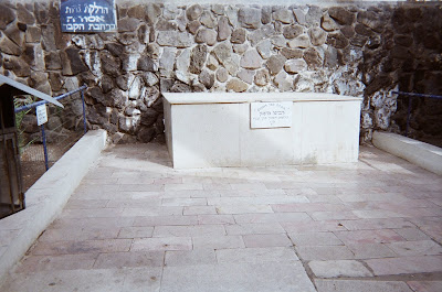
The second image is that of grave of the father of Maimonides (I can't find anything much about the life of Maimon but it is possible he was buried in Egypt and then reinterred in Tiberias).

The third is that of the grave of Maimonides. Maimonides died in Egypt in 1204 but there is no evidence of him being buried in Egypt. Beginning in about 1250, there were traditions that Maimonides was buried in Tiberias, at the this site.

Tiberias - Tomb of the Three Amoraiyim


About a half mile west of the tomb of Maimonides and about 20 feet from a Renault/Nissan dealer (so the parking is very easy and convenient) is the tomb of three of the Amoraiyim whose comments are in the Palestinian Talmud.


The sign lists the three. The Palestinian Talmud is not considered as important as the Babylonian Talmud and similarly, the sages of the Palestinian Talmud are not generally considered as important.


However, Rav Yochanon (the last of them listed on the stone) is an exception to that rule. He is in both the Palestinian and the Babylonian Talmud (although he never visited Babylonia apparently the Babylonians thought very highly of him and quoted him). He also has interesting nickname. That name is "son of the blacksmith" (of bar Nafcha). There is an extensive wikipedia site devoted to him that uses this nickname.

Tiberias - Tomb of Akiba

Rabbi Akiba is pretty important in Judaism and, if he were really buried here his grave would be nearly as important as shrine as that of Maimonides. However, it is pretty unlikely that he was buried here because he was executed by the Romans about the time of the Bar Kochba revolt (in 135) presumably near the imperial administrative center in Caesaria (about 60 miles to the west) and buried near there by either Akiba's followers or Roman soldiers.

Notwithstanding th
at, his gravesite area is a very nice place in which to see the Sea of Galilee.

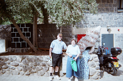
The first image is of me and Ann. To my left right near the lake is the area of Tiberias that used to be the old city. The tall hotels are prominent.


In the picture with Beth you see a little more of the city to her right.

In the picture with Ann and Beth you see a lot of the northern part of Tiberias (which currently has about a population of 45,000).

There are two pictures of the tomb itself.

In the first is a close up which shows how they partition off the tomb so some of it is on the men's side and some on the women's side.

The last picture shows the tomb with its housing.

Wikipedia has a good website devoted to Akiba (aka, Akiba ben Joseph).

There are a number of Jewish educational institutions named for Akiba (not quite as many as are named for Maimonides)

More at Herzilya


Here are some images from the Marina Towers area where we stayed.

The first image shows Murphy's tavern. There is a Murphy's tavern in Alexandria, VA (site of a famous visit b
y M and G when G was about 10 yr old) and a Murphy's tavern in Wash DC near the Woodley Metrorail station.

The second picture is taken from the sea (off the Marina towers Promo website) and shows the towers themselves. We stayed at the one on the left.

The last image i
s of a sunset as seen from the plaza near the marina (maybe from the part near Murphy's Tavern).
Ann and I had a couple of sunsets that we saw while sipping wine but none were as good as this one (from the internet).

Finally, there is a virtual tour of the arena shopping mall (which is adjacent to Marina Towers) at this website. Ann bought some bed sheets for Beth and some Ahava skin lotion there.

Return to the US - Oct 20


Early in the morning (3am) of the 20th we got up and returned the car to Avis near Ben Gurion Airport (it only cost us about $380 plus of course we will be charged for the parking ticket - this is way less than what we paid for a similar number of days in Colorado). We had a flight to London and another to Dulles. On both, we had a whole row of seats to ourselves. We got to Dulles about 630 pm EDT on the 20th (which would correspond to 12:30 am on the 21st Israel time). It took another hour or so to get through customs, get on a shuttle and get home.

Monday, November 24, 2008

Israel 2008 Post and links

Monday, November 24, 2008


M and A in Israel Visiting Beth


Nov 13-23, we were in Israel. The day we came we boarded a sharoot outside the Ben Gurion Terminal building and headed toward Jerusalem.

It only took about 1.5 hours from the time we landed until we had passed customs and passport inspection, got our luggage, boarded the sharoot and got to the apartment we were renting in the German Quarter. Beth lives about a 20 minute walk south of that apartment.

Just as we got to the municipal limits of Jerusalem we saw a rainbow (a storm was ending). The image was taken by someone named Jim Zukerman in 2001).

We ended our vacation at the Havat Habaron hotel. The first image - which was taken by an anonymous person shows the way the hotel is built into a ridge. The ridge is at the east edge of the coastal plain about seven miles or so south of Haifa.


We also saw a rainbow the day before we left at the end of a storm which left a lot of rain on Sabbath the 22nd (at least a lot of rain at the hotel).

I have six separate multi-image posts in the Weissfamily blog.

One is all about Zichron Yaacov.

One contains some odds and ends of Jerusalem and Tel Aviv.

One contains images taken of a large model of Jerusalem in the time of the second temple.

One contains images taken at the dead sea (both taken by Beth)

One contains images taken in the Old City.

Two contain images taken at Neot Kedumim (and one other image from there taken by Beth, others by M)